
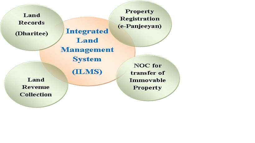
Maintenance of authentic land records is key to efficient management of land. Manual system of record keeping has not proved adequate and been marked by opacity, untimely updation or non-updation, corruption and harassment to the people. State Government took the decision to launch web-based Integrated Land records management System as an answer to all these problems by ensuring interconnectivity among the Revenue Circle, Sub-registrar, Deputy Commissioners' offices and the Directorate of land Records. The Integrated land Records System has four components – online system of issuing NOC for the transfer of immovable property, as required under section 21A of the Registration Act, Dharitry - online system for updation of land records, e-Panjiyan – online system for registration of property, and online system for land revenue collection. All these four systems can talk to one another and ensure optimum efficiency, transparency and accountability in the revenue administration.
The Integrated Land Records Management System ensures that all the processes for the transfer and registration of land and updation of land records, like, Mutation, partition, Conversion, and Reclassification, and land revenue collection are handled online and people will have access to the land records online. Endeavour is being made to equip it with the facility of online payment though the payment gateway provided by State bank of India and next step is to link it up with the systems of the institutions like Banks, Cooperative Societies, Urban Local Bodies etc, so that the delivery of services which require verification of land records get fast and hassle-free. One important aspect of land records management is the availability of maps that mirror ground realities. Significant strides have been made in this area by digitising about 26000 village maps with the help of ASTEC and integrating them with Dharitry through the software called: Bhu-naksha. There are still about 2500 villages which Integrated Land Records Management system(ILRMS)
Maintenance of authentic land records is key to efficient management of land. Manual system of record keeping has not proved adequate and been marked by opacity, untimely updation or non-updation, corruption and harassment to the people. State Government took the decision to launch web-based Integrated Land records management System as an answer to all these problems by ensuring interconnectivity among the Revenue Circle, Sub-registrar, Deputy Commissioners' offices and the Directorate of land Records. The Integrated land Records System has four components – online system of issuing NOC for the transfer of immovable property, as required under section 21A of the Registration Act, Dharitry - online system for updation of land records, e-Panjiyan – online system for registration of property, and online system for land revenue collection. All these four systems can talk to one another and ensure optimum efficiency, transparency and accountability in the revenue administration.
The Integrated Land Records Management System ensures that all the processes for the transfer and registration of land and updation of land records, like, Mutation, partition, Conversion, and Reclassification, and land revenue collection are handled online and people will have access to the land records online. Endeavour is being made to equip it with the facility of online payment though the payment gateway provided by State bank of India and next step is to link it up with the systems of the institutions like Banks, Cooperative Societies, Urban Local Bodies etc, so that the delivery of services which require verification of land records get fast and hassle-free.
One important aspect of land records management is the availability of maps that mirror ground realities. Significant strides have been made in this area by digitising about 26000 village maps with the help of ASTEC and integrating them with Dharitry through the software called: Bhu-naksha. There are still about 2500 villages which are either unsurveyed or map-sheets for which are not available, but Bhu-naksha is proving to be a great tool in the hands of land Records staff for updating the land records and correcting the instances of mismatch between the textual data and maps.
An effective system of record-keeping also requires proper maintenance of old records. State Government has taken up construction of 129 Modern Record Rooms in the Deputy Commissioner Offices and Revenue Circles. The MRRs have computerized Document management System which not only facilitates safe upkeep, but also an easy retrieval of the records. Once all of them are completed, it will be ensured that they become part of the integrated land Records management System.
For all these institutional and e-governance initiatives to wok satisfactorily, it is necessary that there are instrumentalities available to monitor the functioning of those responsible for making them work. State Government has taken two major initiatives to enforce accountability. Management Information System (MIS) for Revenue Administration has been created as a comprehensive instrumentality to make available all the relevant information at one place and standardise the system of reporting. Of various modules, one is particularly fascinating and might be first of its kind in the whole country i.e. the module on Summary of Revenue Villages. This is one-stop gateway to all the useful information about each of the revenue villages in the state. Deputy Commissioners, Subdivisional Officers, Circle Officers and Sub-registrars are required to update all the modules on regular basis and furnish online certificates by 7th of every month to the effect that necessary updation has been done.
The second important instrumentality is e-Safar, the web-based system for recording and monitoring the tours and inspections by the departmental functionaries. Assam land Records manual requires the field level functionaries like, Circle Officer, Supervisory Kanungoes and Lot Mandals, to visit the villages during autumn, winter and Spring seasons to update the basic land record called Chitha and also to share with the community the status of land records. Reputed environmentalist Paul Brookes lamented that In America today you can murder land for private profit. You can leave the corpse for all to see, and nobody calls the cops. To ensure that such a situation does not arise it has been made mandatory to enter the advance village visit programmes of these functionaries on e-Safar and the system makes it possible to monitor if the visits were actually undertaken, visit reports furnished and status of action taken on those reports.
State Government is aware that managing such an array of initiatives is not possible through the regular administrative set-up. It decided, therefore, to create Assam Land Management and Information Society (ALMIS) under the Societies Registration Act to support and overse Integrated Land Records Management system(ILRMS)
Maintenance of authentic land records is key to efficient management of land. Manual system of record keeping has not proved adequate and been marked by opacity, untimely updation or non-updation, corruption and harassment to the people. State Government took the decision to launch web-based Integrated Land records management System as an answer to all these problems by ensuring interconnectivity among the Revenue Circle, Sub-registrar, Deputy Commissioners' offices and the Directorate of land Records. The Integrated land Records System has four components – online system of issuing NOC for the transfer of immovable property, as required under section 21A of the Registration Act, Dharitry - online system for updation of land records, e-Panjiyan – online system for registration of property, and online system for land revenue collection. All these four systems can talk to one another and ensure optimum efficiency, transparency and accountability in the revenue administration.
The Integrated Land Records Management System ensures that all the processes for the transfer and registration of land and updation of land records, like, Mutation, partition, Conversion, and Reclassification, and land revenue collection are handled online and people will have access to the land records online. Endeavour is being made to equip it with the facility of online payment though the payment gateway provided by State bank of India and next step is to link it up with the systems of the institutions like Banks, Cooperative Societies, Urban Local Bodies etc, so that the delivery of services which require verification of land records get fast and hassle-free.
One important aspect of land records management is the availability of maps that mirror ground realities. Significant strides have been made in this area by digitising about 26000 village maps with the help of ASTEC and integrating them with Dharitry through the software called: Bhu-naksha. There are still about 2500 villages which are either unsurveyed or map-sheets for which are not available, but Bhu-naksha is proving to be a great tool in the hands of land Records staff for updating the land records and correcting the instances of mismatch between the textual data and maps.
An effective system of record-keeping also requires proper maintenance of old records. State Government has taken up construction of 129 Modern Record Rooms in the Deputy Commissioner Offices and Revenue Circles. The MRRs have computerized Document management System which not only facilitates safe upkeep, but also an easy retrieval of the records. Once all of them are completed, it will be ensured that they become part of the integrated land Records management System.
For all these institutional and e-governance initiatives to wok satisfactorily, it is necessary that there are instrumentalities available to monitor the functioning of those responsible for making them work. State Government has taken two major initiatives to enforce accountability. Management Information System (MIS) for Revenue Administration has been created as a comprehensive instrumentality to make available all the relevant information at one place and standardise the system of reporting. Of various modules, one is particularly fascinating and might be first of its kind in the whole country i.e. the module on Summary of Revenue Villages. This is one-stop gateway to all the useful information about each of the revenue villages in the state. Deputy Commissioners, Subdivisional Officers, Circle Officers and Sub-registrars are required to update all the modules on regular basis and furnish online certificates by 7th of every month to the effect that necessary updation has been done.
The second important instrumentality is e-Safar, the web-based system for recording and monitoring the tours and inspections by the departmental functionaries. Assam land Records manual requires the field level functionaries like, Circle Officer, Supervisory Kanungoes and Lot Mandals, to visit the villages during autumn, winter and Spring seasons to update the basic land record called Chitha and also to share with the community the status of land records. Reputed environmentalist Paul Brookes lamented that In America today you can murder land for private profit. You can leave the corpse for all to see, and nobody calls the cops. To ensure that such a situation does not arise it has been made mandatory to enter the advance village visit programmes of these functionaries on e-Safar and the system makes it possible to monitor if the visits were actually undertaken, visit reports furnished and status of action taken on those reports.
State Government is aware that managing such an array of initiatives is not possible through the regular administrative set-up. It decided, therefore, to create Assam Land Management and Information Society (ALMIS) under the Societies Registration Act to support and oversee Integrated Land Records Management system(ILRMS)the implementation of all these initiatives. Located in the office of Directorate of land Records, ALMIS has pre the implementation of all these initiatives. Located in the office of Directorate of land Records, ALMIS has professionals engaged on contractual basis to do the monitoring and also to take care of the Central data Centre located therein. Besides, a new service called Assam land Revenue Service was created considering the growing need for specialization in the field of land management and it has also been decided to reorganise the existing set-up of field level functionaries in the form of Assam Subordinate Revenue Service with a view to creating better promotional avenues and utilising their empirical knowledge at higher levels of revenue administration.
Department has put a lot of emphasis on the capacity-building of the revenue functionaries to equip them with the required know-how and skills to manage these changes. In addition to structured classroom based training, arrangements have been made to provide continuous onsite support through State and District Dharitry teams. To further strengthen the District Dharitry Teams Government decided to provide Consultants for Integrated Land Records Management System at the district level. Besides, a momentous decision was taken to engage Field Officer (Disaster Management) in each of 154 Revenue Circles with the specific purpose of enhancing the capacity of Circle offices for working with the VLMCCs and to prepare VLUPs and Village Master plan for conservation and Disaster Management. Field Officers are required to take the messages on ethical relationship with land and prepared of the community to cope with natural and man-made disasters.
State Government has been appreciative of the fact that capacity-building is based pursued by creating an eco-system conducive for self-directed learning and meaningful communication, both vertical and horizontal. A multi-pronged strategy has been worked out to create that ecosystem. A web-based interactive Knowledge Management System is being developed for the departmental functionaries to be able to keep abreast of the progressive and innovative developments relating to their functional landscapes within or outside the country and share their own experiences and ideas. Secondly, it has been decided to utilise the NIC's SMS gateway to share educative information capsules on important areas of conservation and disaster management. Thirdly, periodic review meetings are being designed as fora for knowledge-sharing through the institutional mechanisms like District Disaster management Authority (DDMA), Circle Disaster Management and Conservation Committee (CDMCC) and Village land management and Conservation Committee (VLMCC). The process of knowledge sharing is never complete unless it provides ample scope for the sharing of the tacit knowledge of the people on the ground. Wendell Berry makes the same point when he says that as knowledge expands globally it is being lost locally. This is the paramount truth of the modern history of rural places everywhere in the world. And it is the gravest problem of land use: Modern humans typically are using places whose nature they have never known and whose history they have forgotten; thus ignorant, they almost necessarily abuse what they use.
There is also a serious and well-conceived effort to strengthen the organisational for the survey and re-survey. Process of replacement of old methods of survey by introduction of modern equipments like, DGPS, ETS etc. has already been started and survey officials have been trained in the use of these equipments. It is now under active consideration of the Government to upgrade the organisation into a full-fledged Directorate of Survey and replace the existing system of periodic Survey and Resettlement Operations that take decades to be completed by the concept of continuous survey and updation of records by creating Survey Wings in Deputy Commissioner offices. Two other major challenges are preparation of Village land Use Maps using remote sensing technology and ground truthing and GIS mapping of the critical land masses such as VGRs/PGRs and wetlands. A modest beginning has been made in both the areas, but it is a mammoth task and requires sizable financial resources.
Information systems Integration is a commonly used term that can mean all things to all people. In a broad sense, the meaning of integration has become synonymous with a functional goal of greater efficiency, effectiveness and competitiveness in organisations.
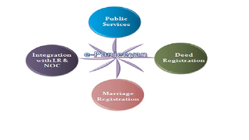
The Integrated Land Management System (ILRMS) is one of the ambitious projects for Revenue and Disaster Management Department, Government of Assam to bring about transparency and efficiency in land administration. Accordingly, the current department-centric approach of digitization will make way for a service-centric architecture. The system will deliver the entire scope of land-related services to the end users through a single window interface.
The ILRMS is a Web-based software system to capture, transmit, store, retrieve, manipulate, or display information, thereby supporting people, organizations, or other software systems. The solution enables the Revenue and Disaster Management Department to:
Figure – 1 Bubble Diagram of ILMS
The objective of the ILRMS is to increase the efficiency of the Revenue Administration through automation of workflow, backend digitization, integration of multiple applications of the department and adoption of innovative modern technology for service delivery.
The core aim of the ILRMS would be to build convincing system with a provision for G2G, G2C, G2B services with the aim to implement the guidelines issued by the Digital India Land Records Modernization Programme, Government of India, which will be based on following principles:
Revenue and Disaster Management Department has been using multiple IT systems designed and developed by National Informatics Center (NIC), Assam State Centre. Application software have been designed considering the requirement of the department at that time, limiting access of updated data and information to the users of the application software. Department essentially need a comprehensive integrated technology architecture and framework to manage the seamless flow of information amongst these applications. Accordingly, the department has adopted the ILMS to provide services to all the Stakeholders. Following diagram depicted the Technical Architecture of the existing ILMS:
Figure –2 Technical Architecture
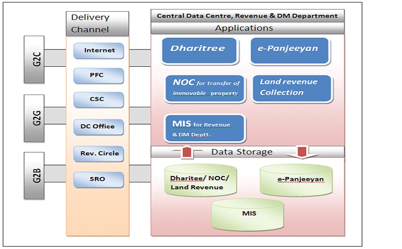
DC Offices →Deputy Commissioner Office; Rev. Circle→Revenue Circle Office; SRO→Sub Registrar Office ; PEF→ Public Facilitation Centre; CSC→Common Services Centers
Services offered by various application:
| Sl.No. | Application | G2G | G2C | G2B (Future Road map) |
| 1. | Dharitee | Mutation, Partition, Correction, Reclassification,MIS Reports for various level of administration | Record of Right, Land Income Certificate, Possession Certificate, SMS. | e-Payment |
| 2. | e-Panjeeyan | Assessment of Stamp Duty,Workflow based Document, Workflow based registration, Marriage Registration, MIS Reports for various level of administration,
| Assessment of Stamp Duty,Slot Booking for Registration, Application for Marriage Registration, Online status for Slot Booking for Registration, Deed Search,SMS. | e-Payment, e-Stamping |
| 3. | NOC for transfer of Immovable Property | Workflow based Processing of NOC, Raised objection, Generate and upload NOC. | Apply for NOC, Blocking of issuance of NOC, Online status for NOC,Download NOC, Apply for extension of NOC, SMS. | e-Payment |
| 4. | Land Revenue Collection | Assessment of Mouza-wise Land Revenue Collection, MIS Reports for various level of administration. | Land Revenue Payment Receipt, Assessment of Land Revenue, SMS | e-Payment. |
Workflow of Integrated Land Records, Registration of Immovable Property,
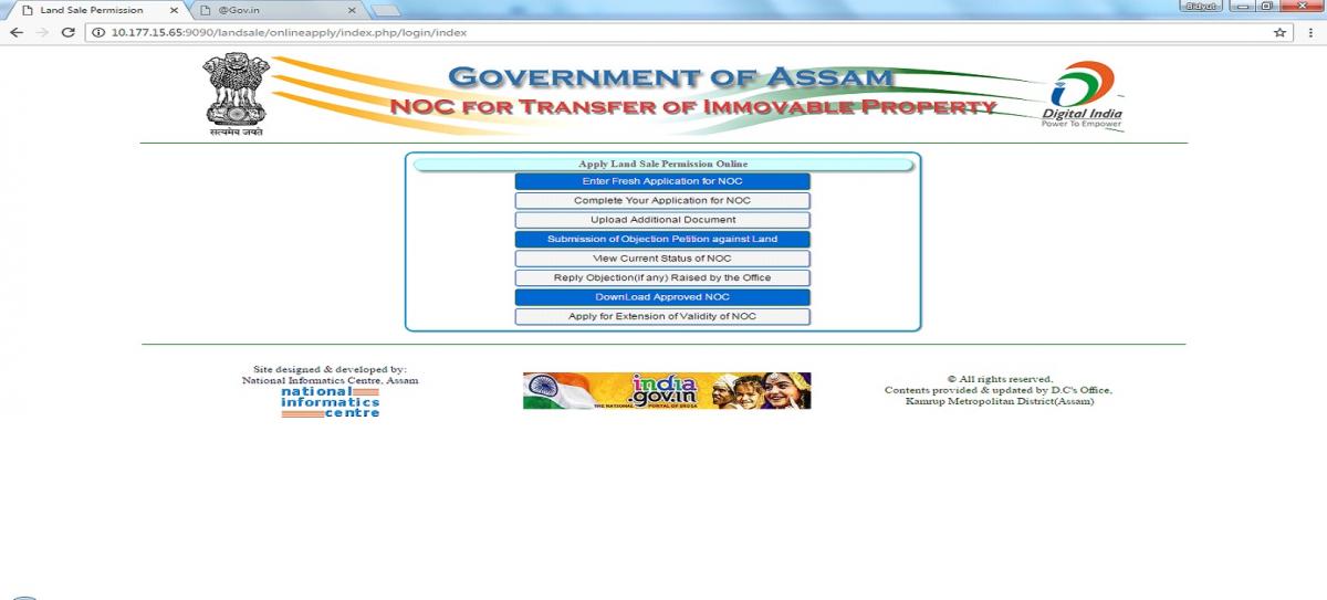
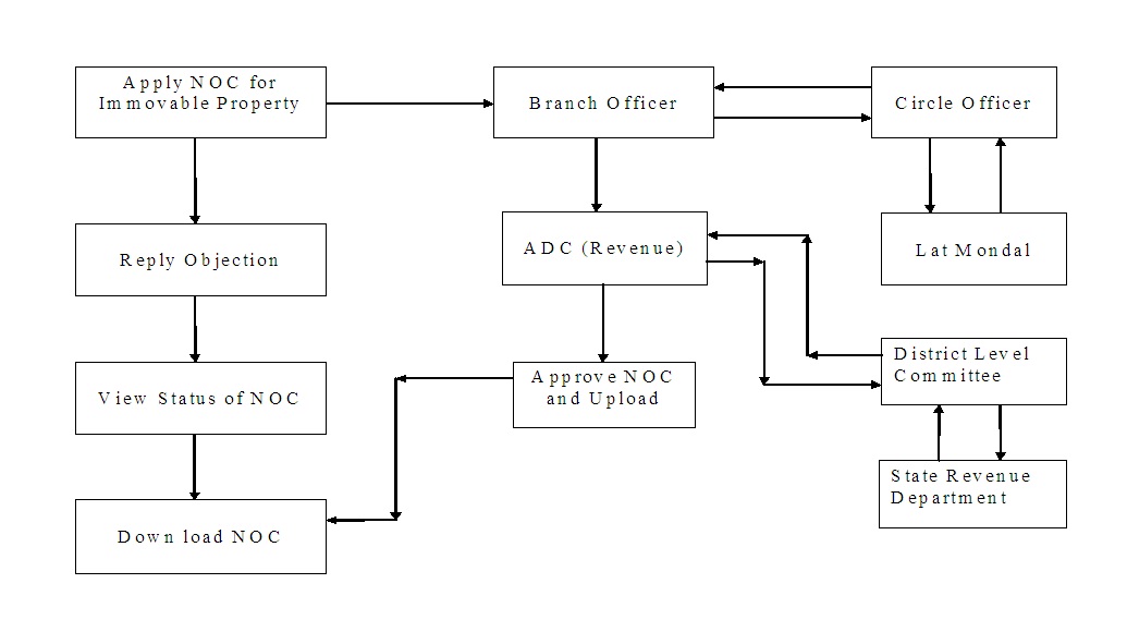
Issuance of No Objection Certificate (NOC) for transfer of immovable property
Land or Property transfer refers to the changes in ownership and whenever you buy a piece of land/immovable property, you need to take permission and register the same with the authority concerned, so that a legal ownership title is guaranteed to you.
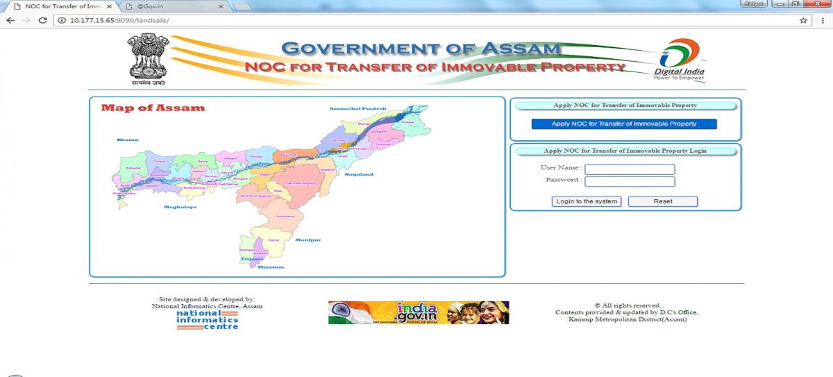
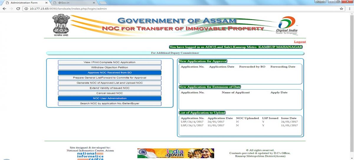
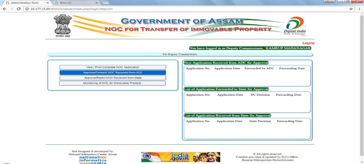
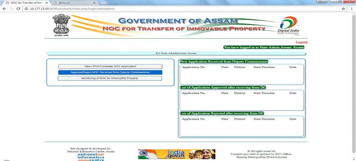
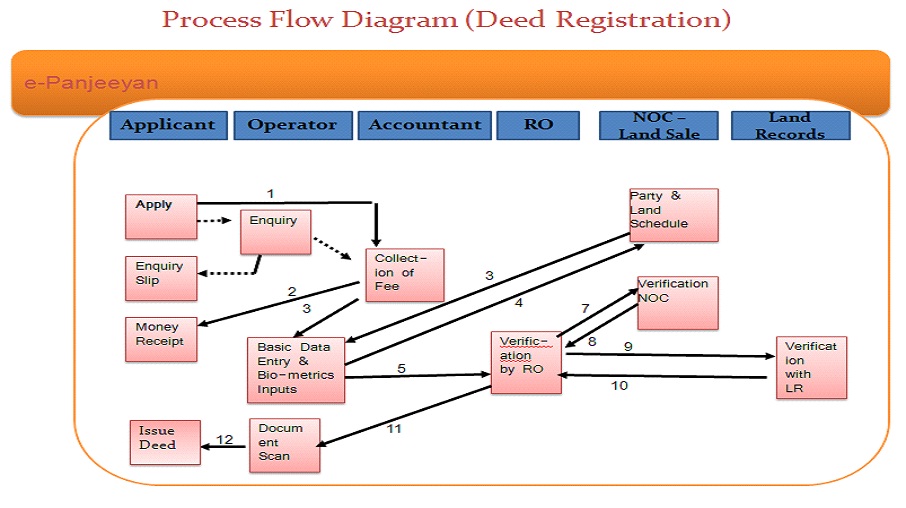
To transfer Land or Property one has to obtain NOC for transfer of immovable property from the authority as required under section 21 of Registration Act 1908. The procedure involved obtaining a Certificate from the Circle Officer and submits the application in the Deputy Commissioners Office and finally the Deputy Commissioner will issue the NOC. After issuing the NOC the Applicant can go for Registration and subsequently do the mutation of the Land.
With the introduction of the newly designed and developed NOC for transfer of immovable property, obtaining NOC will become easy and hassle free as shown in the comparison of Manual System and Computerised System as below:
Modules for General Public
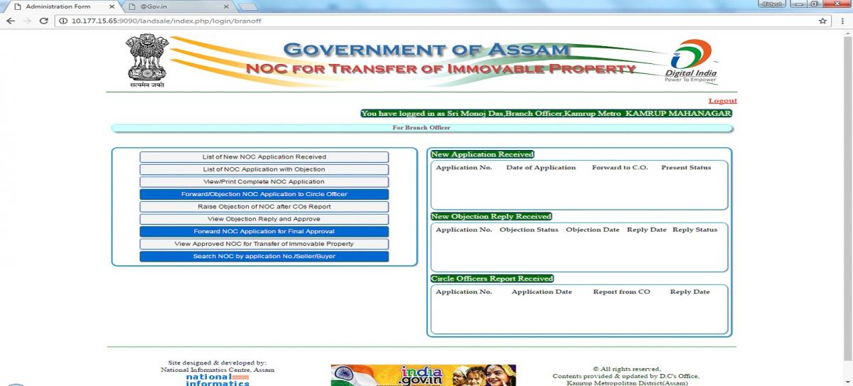
Module for Branch Officer
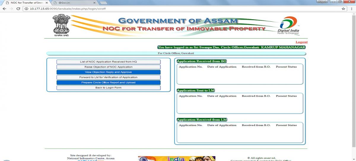
Module of Circle Officer
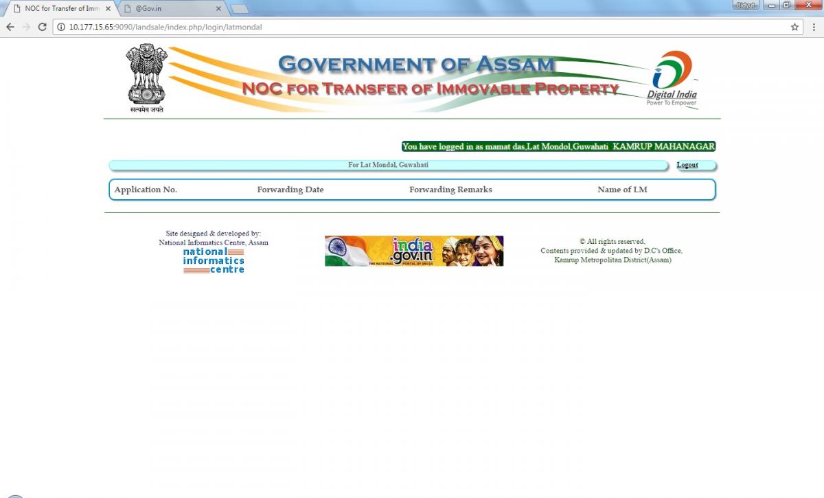
Modules of Lat Mondal
Modules of ADC(Revenue)
Modules of DC/District Level Committee
Modules of State Revenue Department
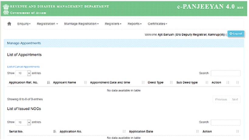
The Revenue and Disaster Management Department (R&DM), Government of Assam has initiated the state-wide rollout of Computerization of Registration. In Assam there are 75 Sub-Registrar Offices out of which 4 Sub-Registrar Offices under the Pilot Project has already been computerized under the Department of Information Technology, Government of India’s ‘Horizontal Transfer of Successful e-Governance Program’ scheme. After successful implementation of pilot project it has been rolled out in remaining Sub-Registrar Offices.
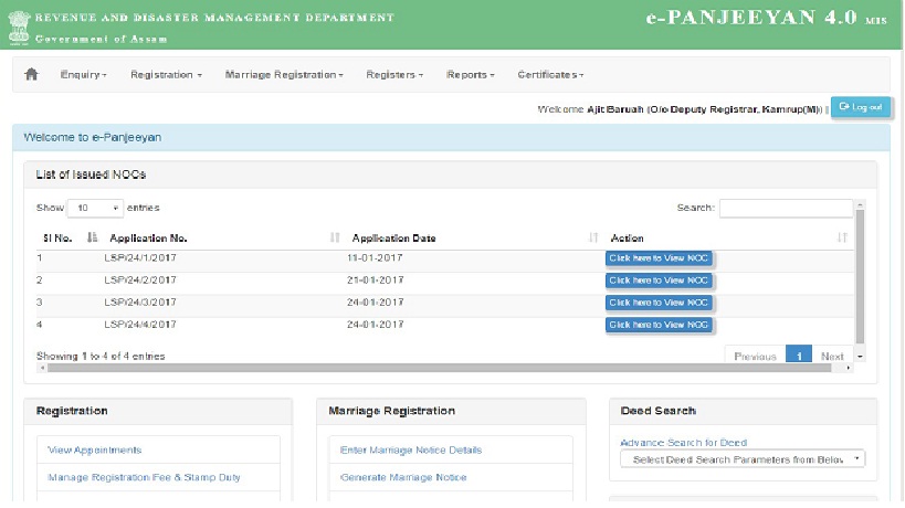
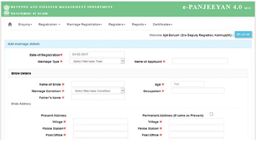
The software solution (e-Panjeeyan) for the Computerization of Registration Project has been provided by National Informatics Centre (NIC), Assam State. The software is designed as per the rules of Registration Act and built with the objective of providing operational and decision-making support to all activities of Sub-Registrar Office. The application software provides solutions for the Pre-Registration, Registration and Post-Registration activities of Sub-Registrar’s office. It also supports integration with the System of No Objection Certificate (NOC) for Transfer of Immovable Property and Land record.
The Technological solution adopted is as follows: The four layers used in the system are
To Citizen:
To Department:
Government to Citizen (G2C):The services offered by the system for citizens are as follows:
Government to Government (G2G):The services offered by the system for the government are as follows:
Government to Business (G2B):
The system is integrated with e-Stamping system for verifying and locking of the certificate issued by SCHIL by the Sub-Registrar after registering the document.
Training on ICT and Application software is used as an effective tool of the Change Management Plan for skill building and creating an interest around the project and also for providing confidence to the employees about the change process and its benefits which ensures least resistance from employee’s with regard to changes in the processes and systems.
Feedback analysis and corrective action are used to follow-up with the employees to understand how the changes are working. The feedback gathered helps in developing corrective actions and post-implementation change management activities.
Modules for Citizen:
Modules for Sub Registrar:
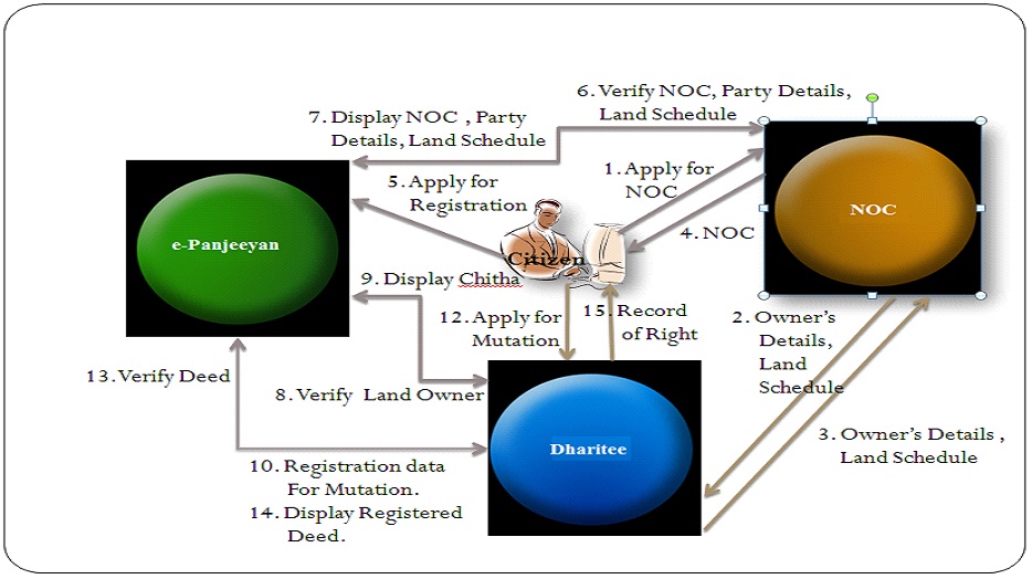
The e-Panjeeyan system will provide seamless exchange of information with NOC for Transfer of Immovable Property and Land Record (Dharitree) system. The integration will primarily facilitate the following:
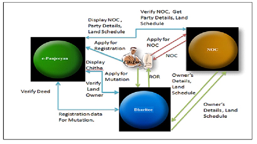
The following diagram depicted the Flow of information between system of e-Panjeeyan, NOC for Transfer of Immovable Property and Dharitree:
The integrated Computerised Land Records System (CLRS) has been designed to maintain up-to-date land records by providing the following workflow-based functionalities into it:
It provides functionalities to provide following land records documents to Citizens:
Additionally, it provides the following functionalities: